13.2 Minnesota a History of the Land 5: The Forest that Remembered Fire

The Forest That Remembered Fire
A young forester once looked across a burned Boundary Waters landscape and thought the forest had ended. Then he spent a lifetime learning that the blackened trees were not the end of the story. They were evidence.
In 1939, a young Minnesotan named Miron "Bud" Heinselman paddled into the Boundary Waters and crossed a landscape burned by a huge fire only a few years earlier. Pink granite showed through. Black snags stood where forest had been. To Heinselman, as to most Americans trained by the catastrophes of the logging era, the meaning seemed obvious: fire destroyed forests.
He was wrong, and discovering exactly how he was wrong became one of the great pieces of ecological detective work in Minnesota history. Heinselman eventually learned that a northern forest does not merely survive occasional disturbance. Its species, ages, openings, seedbeds, wildlife habitat, and even its apparent wildness are partly created by a recurring disturbance regime. Fire was not an interruption of the Boundary Waters story. Fire was one of the authors.
This reading is about how a forest stores history: in rings, scars, seed cones, species mixtures, and patches of trees that are older or younger than their neighbors. It is also about a more difficult idea. Once people alter the frequency of fire, fragment forests with roads and homes, and warm the climate, the old history does not simply repeat. The forest remembers. But it also changes.
When fire became the enemy
If you had lived through northern Minnesota's logging era, you would have had excellent reasons to hate fire. The mistake was assuming that every fire was the same thing.
The great pine logging boom left behind a new kind of landscape. Cut branches, tops, bark, and other logging slash accumulated where enormous trees had been removed. Drought and wind could turn that debris into fuel. Fires such as Hinckley in 1894 and the Cloquet-Moose Lake disaster of 1918 killed hundreds of people and erased communities. Those were human catastrophes as much as ecological events, intensified by the geography of settlement and industrial logging.
The public lesson was simple because simple lessons are useful in emergencies: fire is the enemy. Fire towers, patrols, roads, aircraft, and eventually Smokey Bear helped make suppression one of the central missions of twentieth-century forestry. When homes, workers, towns, and infrastructure are exposed, putting out a fire can be exactly the right thing to do.
But an ecological system can make trouble for a slogan. Northern Minnesota had burned for thousands of years before sawmills arrived. Some fires moved through the understory and left large pines standing. Others killed most of a stand. Some burned a few acres; others crossed enormous areas. A forest that evolved with this variety of disturbance was not necessarily healthier when every flame was removed.


Interactive: the same word, three different forests
Choose a fire history. Watch what changes. The point is not that one outcome is always "good" and another "bad." The point is that severity and frequency matter.

Bud and the mystery hidden in the trees
Heinselman did not begin with a machine that could tell him the past. He began with a canoe, aerial photographs, maps, tree rings, and an unreasonable amount of patience.
In 1966, Heinselman began a major U.S. Forest Service study of the Boundary Waters. His question sounds modest: how often had these forests actually burned? Answering it required reconstructing centuries of landscape history across hundreds of thousands of acres.
He first used aerial photographs to distinguish patches of forest. A stand dominated by jack pine might differ in age and origin from a nearby patch of red pine, birch, or aspen. Then came the field work. He and assistants paddled canoe routes, crossed obscure portages, bored cores from living trees, studied fire scars, and compared tree ages from stand to stand. Each measurement was small. The pattern emerged only after many measurements were placed on a map.
An increment borer can extract a slender cylinder of wood from a living tree. Count the annual rings and you have an estimate of the tree's age. Find many jack pines that established within the same narrow period, and you may be looking at a cohort that followed a severe fire. A surviving pine with several fire scars can tell a different story: the stand burned, but not every tree died.


Interactive: reconstruct a fire history
You are standing in one imaginary Boundary Waters stand. Collect four kinds of evidence. None is decisive by itself. Together they let you build a defensible interpretation.
Evidence notebook
Best interpretation
A forest is not a cathedral. It is a mosaic.
The postcard image of an ancient, unchanging pine forest is beautiful. Ecologically, it is misleading.
Heinselman's maps revealed what he called a shifting forest mosaic. Lakes, wetlands, streams, moist slopes, and rocky terrain interrupted some fires and redirected others. A severe burn might create a large young patch. A low-intensity fire might leave old pines scattered above younger growth. Wind could alter the fuels. Insects could weaken a stand. Succession continued between disturbances.
Different trees carried different strategies into this geography. Jack pine often behaves like a sprinter after severe fire. Its thin bark offers little protection, but many cones are serotinous: heat melts resin and releases seed onto open, sunlit mineral soil. Mature red pine is better armored against many surface fires. White pine can also survive some low-severity fires once its bark becomes thick, while fire can help its seedlings indirectly by reducing competitors, opening canopy gaps, and exposing mineral soil.
The result is diversity through time. One patch supplies browse for moose. Another provides large trees and cavities. Another carries dense young growth. Wildlife sees not one forest but a moving arrangement of habitats. The forest's stability is not the absence of change. It is the capacity of the system to keep functioning while its pieces change.


The story Heinselman could not yet fully read
Science advances partly by honoring a great explanation and then discovering where it needs another layer.
Heinselman's work established fire as an integral ecological process, but one question remained difficult: how much of the presettlement fire record came from lightning, and how much from people? More recent researchers have returned to the same landscape with improved dendrochronology and a technique called crossdating.
At 75 sites in and around the Boundary Waters, researchers compared fire scars in living and dead red pines with known ring patterns. The new record found something striking along the historic Border Route. Some open red-pine stands experienced low-severity surface fires about every five or six years during parts of the 1700s and 1800s. Oral traditions and ethnographic evidence also document Ojibwe use of fire to clear camps and trails and encourage valued plants such as blueberries.
That does not mean every Boundary Waters fire was deliberately set. Lightning remained important, especially during drought. It means that the historical forest was neither purely "natural" in the sense of being untouched by people nor simply human-made. It was a coupled landscape in which climate, lightning, water, soils, vegetation, and human decisions interacted.
This changes the meaning of cultural burning. If frequent, careful burning helped maintain some open pine stands, then the later exclusion of both people and fire did not freeze wilderness in an ancient condition. It changed the disturbance regime again.

Putting fire back without pretending we control it
Once foresters understood that excluding fire also changes forests, a new problem appeared: how do you restore disturbance inside landscapes where people now live, work, vacation, and own property?
Decades without surface fire favor species that can tolerate shade and are sensitive to flame. In some northern dry-mesic woodlands, Minnesota DNR describes a modern shift away from jack, red, and white pine and toward more aspen, balsam fir, and red maple. This is not because those species are somehow "wrong." It is because the filters acting on the forest have changed.
Managers now use a toolbox rather than a single answer. A prescribed fire can reduce understory fuels, expose soil, or maintain fire-adapted communities under chosen weather conditions. In some places, monitored lightning fires may be allowed to play an ecological role. Timber harvest can create openings and structural variety, though cutting trees is not ecologically identical to combustion. The most important shift is intellectual: management begins by asking what process a particular site historically experienced.
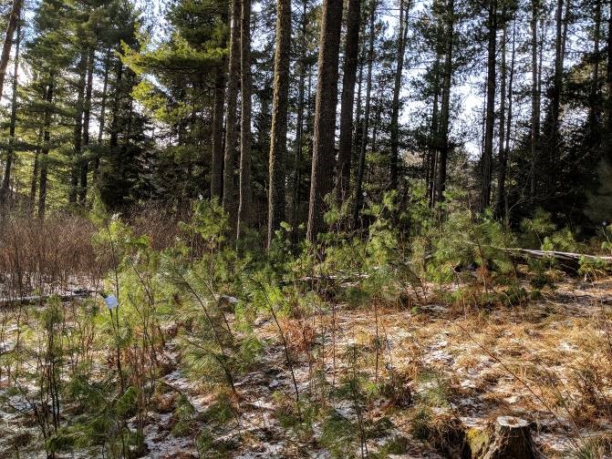
White pine shows why details matter. White pine seeds do not need to be heated open like many jack pine cones. What seedlings often need is exposed mineral soil, enough light, a nearby seed source or planted seedling, and protection from browsing white-tailed deer. A fire can create several of those conditions. So can carefully designed management. The question becomes not "How do we make every acre look old?" but "How do we keep the ecological options open for the forest that follows?"


Interactive: give white pine a fighting chance
Toggle the conditions that help white pine regeneration. The model is simplified, but it demonstrates why "plant a pine" is not a complete management plan.
The seedling is present, but the site is working against it. Add conditions one at a time and watch the probability of successful establishment rise.
Read the site before you choose the forest
The modern forester's map is not only a map of trees. It is a map of moisture, soils, landforms, understory plants, and disturbance history.
Two stands a mile apart can respond differently to the same treatment because they are not the same ecological place. Dry sandy ridges favor different species and fire behavior than moist loamy slopes. Peatlands can stay wet enough to resist ordinary surface fire, then burn deeply during exceptional drought. Lakes and wetlands can fragment the path of a crown fire. Small differences in drainage can become large differences in vegetation after a century.
Minnesota's native plant communities formalize this way of thinking. Understory plants can be especially informative because some have narrower moisture and nutrient requirements than the canopy trees above them. The land is giving clues before the manager makes a decision.


Interactive: let the site tell you what it can become
Choose a landscape position. Notice how the likely fire behavior, vegetation, and management question change together.
Dry sandy ridge
Fast-draining soils and exposed uplands can support jack and red pine. Surface fire may be relatively frequent, while severe fire can create large openings. Management usually favors light-demanding, fire-adapted species rather than shade-tolerant understory buildup.
The forest gets harder to burn on purpose
A fire-management map is also a map of roads, cabins, property lines, utilities, tourism, smoke tolerance, and evacuation.
The North Woods attracts people because it feels forested, secluded, and close to water. Those same desires produce a geographic paradox. As roads, seasonal homes, and year-round residences spread into forested land, managers gain more lives and structures to protect. A fire that might be ecologically acceptable in a remote block becomes much harder to tolerate near homes. Smoke matters. Evacuation routes matter. Property lines matter.
Fragmentation also creates more edge and less interior habitat. It can alter wildlife movement, increase human ignitions, and complicate prescribed burning or fuel treatments across many small ownerships. This is why fire ecology eventually becomes human geography. The biological process is inseparable from where people have decided to build.


Interactive: add development to the forest
Move the slider from a large connected forest block toward a heavily subdivided wildland-urban edge. The forest does not disappear all at once. Its management geometry changes piece by piece.
With few roads and structures, managers have more room to use prescribed fire or tolerate some natural fire under suitable conditions. The risk is never zero, but the decision space is larger.
The old lesson meets a warmer climate
A fire-dependent forest does not live outside climate. Change the temperature and moisture regime, and the same ignition can meet a different landscape.
Minnesota has warmed by about 3°F since 1895, with especially strong warming in winter and at night. Annual precipitation has increased overall, but a wetter climate does not eliminate drought. Warmer conditions can increase evaporation, lengthen portions of the fire season, and produce longer dry spells between heavy rain events.
Northern Minnesota sits near the boundary between boreal and temperate forests. University of Minnesota warming experiments have found that spruce and fir generally lose competitive ground under warming while oaks and maples often perform better. That does not mean the North Woods suddenly becomes southern Minnesota. It means disturbance is now acting on a changing set of competitors. Fire, wind, insects, drought, browsing, and regeneration are interacting with a climate whose old averages are moving.
Then came July 2026. Fires erupted in and near the Boundary Waters beginning July 7 and expanded rapidly. By July 16, more than 50,000 acres had burned, according to the Minnesota DNR, and smoke spread across much of the state. The State Climatology Office described the July 14-17 episode as the most intense smoke pollution outbreak on record in Minnesota, with hazardous air recorded far from the fires themselves.
That contemporary event is a useful final complication. To say that fire is ecologically necessary is not to say every wildfire should burn wherever it starts. Smoke harms people. Homes can burn. Firefighters take risks. Ecosystems can cross thresholds after unusually severe or closely spaced disturbances. The lesson Heinselman helped Minnesota learn was never "fire is good." It was more demanding: understand the system before you decide what the fire means.


Main Points
- Northern Minnesota's logging-era fires were devastating human disasters, but that history encouraged a broader policy of fire exclusion that also altered fire-dependent ecosystems.
- Bud Heinselman reconstructed centuries of Boundary Waters fire history from aerial photographs, tree ages, increment cores, fire scars, and mapped forest stands.
- A roughly 100-year natural fire rotation was a landscape average, not a claim that every place burned once per century.
- Fire helped create a shifting mosaic of forest ages and species. Jack pine, red pine, white pine, aspen, birch, balsam fir, and maple respond differently to disturbance.
- Newer tree-ring research shows that some red-pine stands along historic travel routes experienced very frequent surface fires, many likely connected to Ojibwe cultural burning.
- Modern management can use prescribed fire, monitored natural fire, harvesting, planting, and browsing protection, but no single treatment perfectly reproduces historical disturbance.
- Fragmentation and climate warming change the conditions under which fire occurs and the choices managers have. Fire ecology is therefore also human geography.
Key Vocabulary
Quick Check
Choose the best answer. Feedback appears immediately.
1. What did Heinselman's research most fundamentally change about the interpretation of fire in the Boundary Waters?
2. Why is a 100-year fire rotation not the same as a 100-year fire return interval at every site?
3. Which statement about jack pine and white pine is most accurate?
4. What did newer crossdated fire-scar research add to the Boundary Waters story?
5. Why can forest fragmentation reduce fire-management flexibility?
6. What is the best conclusion from Minnesota's July 2026 fire and smoke episode?
Sources and Further Reading
Foundational Works for the Minnesota Reader
- Hart, John Fraser, and Susy Svatek Ziegler. Landscapes of Minnesota: A Geography. Minnesota Historical Society Press, 2008.
- Heinselman, Miron L. The Boundary Waters Wilderness Ecosystem. University of Minnesota Press, 1996.
- Heinselman, Miron L. "Fire in the Virgin Forests of the Boundary Waters Canoe Area, Minnesota." Quaternary Research 3, no. 3 (1973): 329-382. DOI record.
- Wright, Herbert E., Jr., and Miron L. Heinselman. "The Ecological Role of Fire in Natural Conifer Forests of Western and Northern North America." Quaternary Research 3 (1973). Reprinted in Fire Ecology 10, no. 3 (2014).
- University of Minnesota Bell Museum of Natural History. The Northern Forest, a special production in the Minnesota: A History of the Land educational tradition.
Sources Used / Updates for This Reading
- Minnesota Department of Natural Resources. "Border Lakes Subsection." Fire history, presettlement vegetation, and natural fire rotation. Minnesota DNR.
- Larson, Evan R., et al. "What Is Wilderness?" Minnesota Conservation Volunteer, March-April 2017. New fire-scar research, crossdating, and cultural history in the BWCAW. Minnesota DNR.
- Minnesota Department of Natural Resources. "Northern Dry-Mesic Mixed Woodland - FDn33." Disturbance rotations and modern effects of fire exclusion. Minnesota DNR.
- Minnesota Department of Natural Resources. "Climate Trends." Statewide observed warming, precipitation, and extreme-rain trends. Minnesota DNR.
- University of Minnesota Forest Ecology Laboratory. "Global Climate Change Effects on Temperate and Boreal Forests" / B4WARMED. University of Minnesota.
- Minnesota Department of Natural Resources, State Climatology Office. "Dangerous Smoke Outbreak, July 14-17, 2026." Posted July 16, 2026. Minnesota DNR.
Image Credits
Most historical and forest photographs in this reading are U.S. federal government works from the National Archives, National Park Service, NASA, or U.S. Forest Service and are public domain. The 2026 Ely and Big Sandy Fire Tower photographs are by Lorie Shaull and are used under CC BY 4.0 through Wikimedia Commons. The Heinselman photograph is credited to Kevin Proescholdt and reproduced in the 2014 Fire Ecology reprint. The white-pine regeneration photograph is from the University of Minnesota Great Lakes Silviculture Library.


Comments
Post a Comment