14.2 The Map We Haven't Made Yet
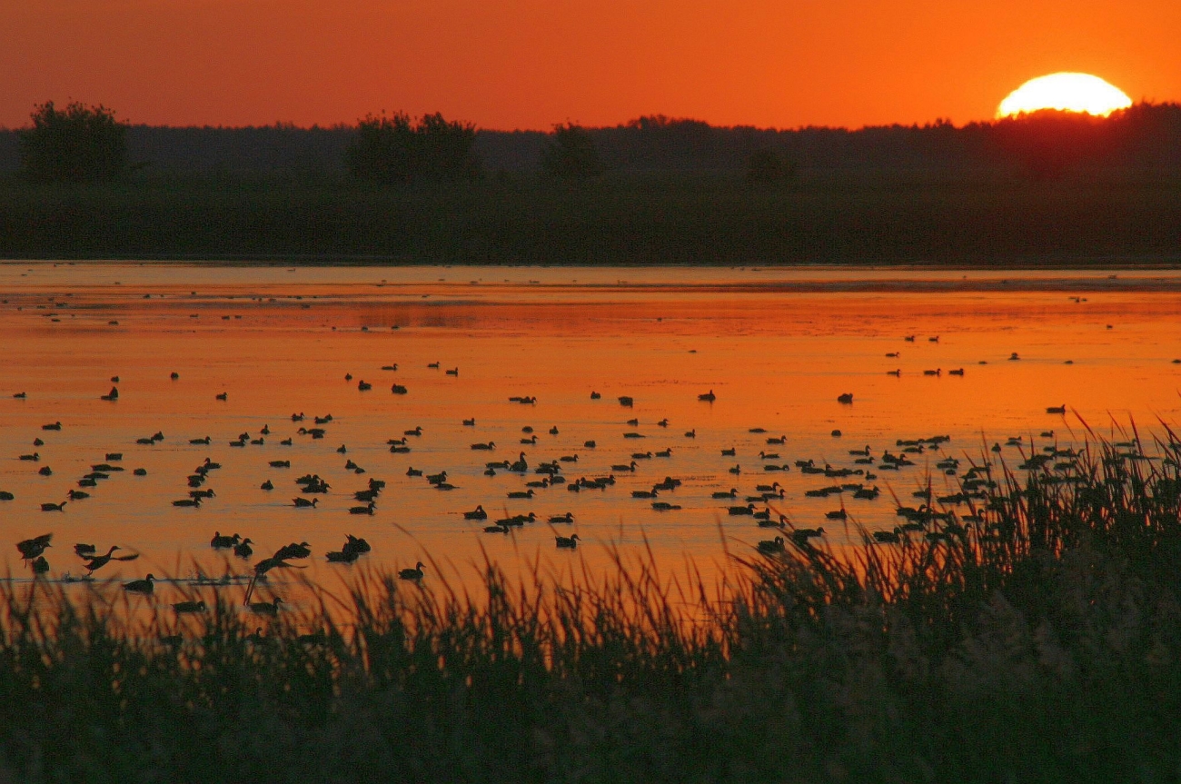
The Map We Haven't Drawn Yet
How Minnesota's future travels through prairies, fields, rivers, forests, data, and decisions
Stand at the edge of a Minnesota prairie and the future looks still. The grass moves because the wind moves it. The fence does not move. The county road seems permanent. This is deceptive. In ecology, nearly everything important is on its way somewhere.
A seed is moving in the wind. A nitrate ion is moving beneath a cornfield. A zebra mussel is moving on a wet trailer. Mercury released hundreds or thousands of miles away is moving through the atmosphere toward a lake. A tree species is, generation by generation, finding that the climate around it no longer behaves quite as it did. Even the people looking after all this are moving information from a satellite, a laser, a field notebook, a ballot box, and eventually into a decision about what happens to a particular piece of ground.
That is a useful way to think about Minnesota's environmental future. It is not a distant year waiting politely at the far end of the calendar. It is a collection of processes already in motion. Forests, prairies, lakes, rivers, and wetlands are not scenery hung behind our lives. They are part of the machinery that makes those lives possible. Indigenous stewardship shaped these landscapes through harvest, fire, seasonal movement, and close attention to ecological limits long before modern resource agencies existed. Modern ecology reaches a related practical conclusion by another route: if we alter a system, we inherit consequences within that system.
A Prairie Becomes an Archipelago
Imagine a square mile of prairie. Now put a road through it. Add another road at right angles. Put houses along one edge, drain the low wet place, and turn the surrounding ground into cropland. You may still have patches of prairie. On a land-cover map they may even add up to an impressive number of acres. But an organism does not live in a spreadsheet. It has to move, feed, reproduce, escape predators, survive weather, and sometimes find another population of its own species.
This is the difference between habitat loss and . A hundred acres in one connected block is not ecologically identical to ten isolated ten-acre patches. The edges multiply, interior habitat shrinks, roads become hazards or barriers, and small populations become more vulnerable to bad years and bad luck. Minnesota's prairies, wetlands, and Big Woods are landscapes where this has already happened on an enormous scale.
Break a prairie
Move the slider from a connected landscape toward roads, parcels, and development. The total amount of green does not vanish immediately, but the amount of uninterrupted interior habitat falls much faster.
That realization changed conservation strategy. A protected island is valuable, but sometimes a connecting two islands is more valuable still. Minnesota's Prairie Conservation Plan explicitly treats the prairie region as a connected landscape extending across political boundaries. The logic is simple and rather beautiful: if habitat has been turned into islands, conservation has to start thinking like bridge building.
Minnesota's conservation funding structure remains unusually substantial. The 2008 Clean Water, Land and Legacy Amendment continues its three-eighths-percent sales tax through 2034, with one-third of that revenue directed to the Outdoor Heritage Fund for wetlands, prairies, forests, and wildlife habitat. The fund's own criteria explicitly include preventing forest fragmentation and expanding restored native prairie.
The Field Does Not End at the Field
Minnesota became one of the country's great agricultural landscapes by learning how to make extraordinary quantities of food on land that had once been prairie, wetland, and woodland. That achievement is real. So are its costs. A plowed field is not a sealed factory floor. Soil moves downhill. Water moves through soil. Fertilizer dissolves. Drainage systems move water faster. And the molecule that makes a corn plant grow does not know where the property line is.
Southeastern Minnesota makes the point vividly: nineteenth-century wheat farming on steep slopes produced spectacular erosion. The damage helped push agriculture toward new practices, but the underlying problem never disappeared. Modern farming is far more productive, and in many ways more conservation-minded, than its predecessors. It also concentrates enormous flows of nitrogen and phosphorus across the landscape, creating the potential for . The future of agriculture therefore depends less on choosing between food and nature than on designing a system in which producing food does not continually export soil and nutrients into somebody else's water.
Follow one nitrogen journey
Click the steps. The important geography is that a nutrient useful in one place can become pollution in another.
Water makes these connections legible. A is simply an area in which gravity arranges the drainage. From a field in southern Minnesota, water may enter a ditch, then the Minnesota River, then the Mississippi, and eventually the Gulf of Mexico. Once you see the system that way, a local fertilizer decision and a distant oxygen-depleted zone stop looking like unrelated events. They are separated by miles, but connected by flow.
The Minnesota Pollution Control Agency estimates that an average of 158 million pounds of nitrate leave Minnesota each year in the Mississippi River, with about 75 percent originating in Minnesota watersheds. The 2025 Nutrient Reduction Strategy estimates that Mississippi River phosphorus loads have fallen about 32 percent from the 1980-1996 baseline, while total nitrogen has fallen by a smaller and less certain roughly 6 percent. This is not a solved problem, but it is no longer a problem we are merely describing.
When Climate Moves the Conditions Under Your Feet
A tree cannot pick up its roots and move to Duluth because July has become uncomfortable. A bird can move. A seed can move, slowly. A forest can move only through generations, as seedlings survive in some places and fail in others. Climate change is therefore not simply warmer weather laid on top of the existing map. It changes the rules by which the map was drawn.
Climate models have become far more detailed than the early global grids of the 1990s, but the larger change is psychological. Minnesota no longer needs a model to tell it that warming is possible. The state has accumulated enough observations to know that it is already happening, especially in winter and at night. The question has moved from whether adaptation might someday be necessary toward how adaptation should work now.
Can the species keep up?
This is a simplified north-south slice of Minnesota, not a forecast for one particular species. The green preserves are legally protected and do not move. The blue band represents the climate conditions a cool-adapted forest population does best in. Warm the climate, then change the landscape from isolated preserves to connected habitat.
This is why reappears in the story. The same strips of habitat that reconnect fragmented prairie also give plants and animals possible routes through a changing climate. Conservation begins to look less like preserving a museum display and more like keeping doors open. Some species will adapt in place, some will move, some will need human help, and some will run out of suitable places faster than they can follow them.
Minnesota's 2025-2035 Wildlife Action Plan explicitly identifies connecting corridors as a way to facilitate species movement and improve resilience to climate change. The corridor in the interactive is simplified; the planning principle is now part of statewide conservation strategy.
Minnesota DNR's climate record now shows that warming is concentrated in the coldest parts of the year and day. From 1970 through 2025, average daily winter low temperatures rose more than twenty times faster than average daily summer high temperatures. The future is therefore already partly an observed Minnesota climate.
A Zebra Mussel Does Not Need a Passport
Climate moves conditions. People move organisms. A boat leaves one lake, crosses a highway, and enters another. Firewood rides north for a weekend. Nursery plants cross state lines. Earthworms arrive in bait containers. A species that spent thousands of years separated from Minnesota by an ocean can now make the journey in an afternoon, provided we carry it.
This is one of the great unintended consequences of a connected world. The same transportation system that makes the modern economy possible also collapses ecological distance. An can cross in hours what geography once kept apart for millennia. Most introduced organisms do not become major problems, but some arrive in ecosystems without the predators, parasites, competitors, or climatic constraints that limited them at home. Then the thing that seemed small enough to fit on a boat trailer becomes a lake-scale event.
How did it get here?
Choose a pathway. Modern invasive-species management often begins by interrupting transportation rather than trying to remove an organism after it has become established.
The DNR's infested-waters list was updated August 14, 2026. About 9 percent of Minnesota's 11,842 lakes are on the list, and about 5 percent are listed for zebra mussels. Those numbers are sobering, but they also explain why prevention still matters: most Minnesota lakes are not listed as infested.
The Smokestack, the Mine, the Fish
For much of the industrial era, pollution was easiest to understand when it came out of a pipe. A factory discharged waste into a river. A city sewer emptied into a lake. Find the pipe, regulate the pipe, build a treatment plant, and the problem could at least be attacked at a recognizable point. Minnesota made enormous progress against those obvious sources.
Then the geography became more difficult. Nutrients came from thousands of fields. Mercury arrived through the air. Old industrial sites kept their chemistry after the factory closed, leaving the problem of the . New synthetic compounds appeared in products and then in wastewater, groundwater, fish, and human blood. Pollution stopped behaving like a local stain and began behaving like a network.
A pollutant does not need to stay where it was released
Pick a route and watch the problem change scale.
Mercury is the elegant and unpleasant example. Once deposited in water, it can be converted into methylmercury, taken up by small organisms, and concentrated as predators eat prey. A molecule becomes more consequential as it climbs a food web through . The geography therefore runs from smokestack to atmosphere to lake to plankton to fish to dinner plate. Environmental management becomes inseparable from atmospheric chemistry, aquatic ecology, and public health.
Mercury remains a statewide fish-consumption issue even after major reductions from many North American sources because atmospheric mercury travels long distances and concentrations in Minnesota fish have not fallen as quickly as emissions. PFAS adds a newer version of the same geographic problem. Minnesota has tested thousands of fish from more than 200 lake, river, and stream segments for PFAS since 2004; by 2026, waterbody-specific PFAS fish-consumption guidance had been issued for 51 waters. The chemistry changed; the ecological lesson did not.
Knowing More Can Make the List Longer
Here is a statistical trap. Suppose a state surveys more carefully and discovers additional rare species or previously unknown populations. The number on a threatened-species list may rise. Has nature suddenly become worse, or has observation become better? Sometimes both are true. An expanding list can therefore record increasing pressure, increasing knowledge, or both at once.
That is why species conservation is partly detective work. A prairie butterfly can disappear because the prairie disappears, but it can also disappear from prairie that looks superficially intact if the right host plants, moisture conditions, fire regime, or connections to other populations are gone. A bat may survive habitat change and then encounter an introduced fungus in a cave. Conservation moves from protecting "nature" in the abstract toward understanding the precise relationships that allow a particular organism to persist.
Threat is rarely one thing
Select a species to see how several pressures can overlap.
There are success stories as well, and the chapter wisely makes room for them. Peregrine falcons, bald eagles, and trumpeter swans show that decline does not have to be a one-way street. The ozone story makes the same point on a planetary scale: scientists identified a mechanism, nations acted, industry changed, and the worst trajectory was altered. Ecology is full of warnings, but a warning is not a prophecy. It is information offered before the ending.
First We Had to Learn to See Minnesota
At some point every conservation problem becomes an information problem. Where are the remaining high-quality prairies? Which wetland still has its original hydrology? Where are rare plants? Which stream is warming? Where has a new invasive species appeared? Which patch of forest connects two larger patches? If those questions cannot be answered, good intentions have nowhere precise to land.
The tools have changed dramatically. Paper maps became geographic information systems. Aerial photographs became continuously growing archives of satellite imagery. sends laser pulses toward the ground and measures the returning light so precisely that vegetation can, in effect, be peeled away to reveal the shape of the land beneath it. But the old-fashioned human being in boots remains stubbornly useful, because a laser can map a depression while a botanist can tell you what is growing in it.
Peel away the canopy
LiDAR can record millions of elevation points. Toggle the forest canopy off to see the underlying landform that may control water, soil, and habitat.
Minnesota's Biological Survey embodies this marriage of map and boot. The project has spent decades building a statewide record of native plant communities, rare plants, rare animals, and places of high biological significance. That database makes modern statewide planning possible in a way that would once have seemed fantastical. Yet more data also reveals more complexity. The better the map becomes, the less often nature resembles a simple map.
The Minnesota Biological Survey reports that initial field survey work has now been completed in all 87 counties. Its statewide databases contain more than 15,000 new rare-species records and more than 10,700 vegetation plots, turning decades of field observations into conservation-planning infrastructure.
You Cannot Put a Prairie Back the Way You Replace a Window
Once we know where the damage is, restoration seems like the obvious next step. Drain a wetland, then restore the hydrology. Plow a prairie, then plant prairie seed. Pollute a river, then remove the pollutant. Sometimes it works remarkably well. But an ecosystem is not assembled from a parts catalogue. Soil microbes, seed banks, groundwater, fire history, hydrology, insects, fungi, and neighboring habitats all carry histories that may not be recreated simply by putting the visible plants back.
This makes both hopeful and humbling. Wetlands can sometimes recover quickly once water is allowed to behave like water again. Prairies may require repeated burning, invasive-species control, seed collection, and years of patient management. A mature forest can be restored as a process, but not instantly as a collection of 150-year-old trees. The goal is usually not to rewind the landscape to an exact date. It is to restart enough of the ecological machinery that the system can once again do some of the work itself.
What exactly are you restoring?
Choose a system. The clock and the difficulty change because ecosystems store history in different ways.
Then Somebody Has to Decide
Here is where an ecology chapter becomes a civics chapter. We can estimate the cost of a sewage treatment plant. We can count acres of restored prairie. We can measure nitrate, map habitat, model climate, and attach transmitters to animals. The difficult question arrives afterward: what do we value enough to pay for, regulate, restrict, restore, or leave alone?
Minnesota has answered that question in unusual ways. Voters approved the Environment and Natural Resources Trust Fund in 1988 and the Clean Water, Land and Legacy Amendment in 2008. The Wetland Conservation Act, groundwater protections, habitat programs, watershed planning, and hundreds of local projects all represent decisions to treat ecological systems as public infrastructure. That does not end arguments over farms, mines, housing, pipelines, forests, or taxes. It changes the argument by admitting that clean water, functioning habitat, and future options have value too.
Environmental and economic decisions cannot really be separated. That may be the most important idea in the entire reading. The economy operates inside a landscape with finite soil, finite water, finite atmosphere, finite habitat, and finite ability to absorb waste. The useful question is not whether Minnesota should choose people or nature. People are already inside the system. The question is what kind of system we intend to leave working.
You have 100 points. Build a Minnesota future.
Allocate your attention across six strategies. There is no official correct answer. The point is to make the tradeoff visible: every serious environmental future is a portfolio, not a slogan.
What to Remember
Habitat is not only acreage; its size, shape, quality, and connectivity matter. Agricultural production connects to distant waters through soil, drainage, and nutrient flows. Climate change moves environmental conditions, which makes corridors and resilience increasingly important. Invasive species exploit the same transportation networks people use. Pollution can travel through air, water, food webs, products, and time. Better surveys may reveal more rare species even as real threats increase. Modern conservation depends on GIS, remote sensing, field surveys, and long-term monitoring, but data is useful only when it guides action. Restoration can restart ecological processes, but it rarely recreates the past exactly. In the end, environmental futures are produced by public and private choices about what to protect, what to change, what to pay for, and how long a time horizon to use.
Questions to Carry Out of the Reading
1. Why can the same total acreage of habitat have very different ecological value depending on how it is arranged?
2. Trace one Minnesota environmental issue across at least three scales, from a local action to a regional or global consequence.
3. How does climate change alter the logic of protected areas even if the boundaries of those areas never change?
4. Why are prevention and monitoring often more effective than trying to repair an ecological problem after it becomes obvious?
5. The chapter argues that environmental and economic decisions are intertwined. Choose one example from Minnesota and explain the tradeoffs without treating either side as cost-free.
Key Terms
- Habitat fragmentation
- The division of a large habitat into smaller, separated patches, usually increasing edge and reducing interior habitat.
- Connectivity
- The degree to which organisms and ecological processes can move among habitat patches.
- Nonpoint-source pollution
- Pollution that comes from many diffuse sources across a landscape rather than one identifiable pipe or outlet.
- Watershed
- An area of land that drains water toward a common stream, river, lake, or other outlet.
- Nutrient pollution
- Excess nitrogen or phosphorus that stimulates ecological changes such as algal growth and oxygen depletion.
- Climate adaptation
- Actions intended to reduce harm or increase resilience as climate conditions change.
- Invasive species
- A nonnative organism whose establishment or spread causes, or is likely to cause, ecological, economic, or other harm.
- Biomagnification
- The increase in concentration of some contaminants at higher levels of a food web.
- Brownfield
- Previously developed land whose reuse may be complicated by actual or suspected contamination.
- LiDAR
- Light Detection and Ranging, a remote-sensing method that uses laser pulses to measure precise elevations and landscape structure.
- Restoration ecology
- The science and practice of assisting the recovery of degraded, damaged, or destroyed ecosystems.
- Resilience
- The capacity of a system to absorb disturbance, reorganize, and continue functioning.
Eight Quick Questions
1. Why can habitat fragmentation harm species even when some habitat remains?
2. What makes nitrate pollution a geographic problem?
3. Why can climate change reduce the effectiveness of fixed protected areas?
4. Which action best prevents aquatic invasive species spread?
5. What is biomagnification?
6. Why might a threatened-species list grow even if survey methods improve?
7. What can LiDAR add to conservation planning?
8. Why is ecological restoration not simply a rewind button?
Foundational Works for the Minnesota Reader
- Tester, John R., Susan M. Galatowitsch, Rebecca A. Montgomery, and John J. Moriarty. Minnesota's Natural Heritage, 2nd ed. University of Minnesota Press, 2021. Chapter 10, "The Future," provides the principal ecological and historical foundation for this reading.
- Hart, John Fraser, and Susy Svatek Ziegler. Landscapes of Minnesota: A Geography. Minnesota Historical Society Press, 2008. Used throughout the Minnesota Reader for the geographic relationship between land, resources, settlement, and change.
Sources Used / Updates for This Reading
- Minnesota DNR - Minnesota Prairie Conservation Plan: native-prairie loss, core areas, corridors, restoration, and connected-landscape planning.
- Minnesota's Legacy - About the Funds and Outdoor Heritage Fund: current funding structure, 2034 expiration date, and habitat priorities.
- Minnesota Pollution Control Agency - Nitrogen: nitrate sources and the estimated 158 million pounds leaving Minnesota annually in the Mississippi River.
- MPCA - Minnesota Nutrient Reduction Strategy: 2025 estimates of phosphorus and nitrogen load reductions.
- Minnesota DNR - Climate Trends: observed Minnesota warming, especially winter and nighttime warming, through 2025.
- Minnesota DNR - Minnesota Wildlife Action Plan 2025-2035: connecting corridors, biodiversity priorities, and climate adaptation.
- Minnesota DNR - Infested Waters List: August 14, 2026 list and statewide aquatic-invasive-species totals.
- MPCA - Mercury: atmospheric transport, fish contamination, and statewide mercury management.
- MPCA - PFAS in Fish: statewide fish monitoring and waterbody-specific consumption guidance.
- Minnesota DNR - Minnesota Biological Survey Status and Outcomes: statewide survey completion, rare-species records, vegetation plots, and conservation mapping.
- Minnesota DNR - Watershed Basins and Minnesota's Biomes: current statewide geographic reference.
Image credits
Photographs and maps are drawn from the U.S. Fish and Wildlife Service, Minnesota DNR, U.S. Forest Service, USDA Natural Resources Conservation Service, U.S. National Archives, U.S. Environmental Protection Agency, Wikimedia Commons, and other public-domain or openly reusable government/archive collections. Each figure carries its specific source credit; click any working image to enlarge it.


Comments
Post a Comment